 Map Measure v.1.1.0.0
Advertisement
Description
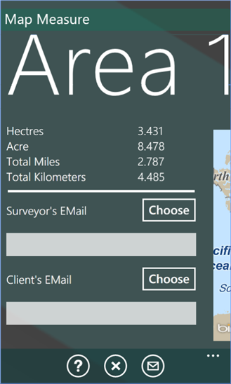
[Map Measure] is a tool for measuring land area. This application is ideal for people who need to know perimeter length and area of a parcel of land. The results are in Kilometers, Miles/Yards for perimeter and Hectares and Acres for area. The calculation of the perimeter and area is taken from the GPS which records points of location.
This tool is ideal for Surveyors, Estate Agents, Farmers, Builders Land Agents,...
Read more
- Rate:
- Release Date:08/20/2012
- License:Freeware
- Category:Recreation
- Developer:Caretaker Systems Ltd
- Downloads:35
- Size:1024 Kb
- Price: Free
To free download a trial version of Map Measure, click here
To visit developer homepage of Map Measure, click here
Advertisement
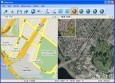
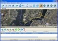
Screen Shot
Click on a thumbnail for the larger image.
System Requirements
Map Measure requires Windows Phone 7 or higher | location services, data services, HD720P (720x1280), WVGA (480x800), WXGA (768x1280) | English
Map Measure v.1.1.0.0 Copyright
Shareware Junction periodically updates pricing and software information of Map Measure v.1.1.0.0 full version from the publisher using pad file and submit from users. Software piracy is theft, Using crack, password, serial numbers, registration codes, key generators, cd key, hacks is illegal and prevent future development of Map Measure v.1.1.0.0 Edition. Download links are directly from our publisher sites. Links Map Measure v.1.1.0.0 from Bittorrent, mediafire.com, uploadfiles.com, hotfiles.com rapidshare.com, megaupload.com, netload.in, storage.to, depositfiles.com and other files hosting are not allowed. The download file is obtained directly from the publisher, not from any Peer to Peer file sharing applications such as Shareaza, Limewire, Kazaa, Imesh, eDonkey, eMule, Ares, BearShare, Overnet, Morpheus, BitTorrent Azureus and WinMX.
Review This Software
More Map Measure Software
Advertisement


KLONK Map Measurement v.15.2.1.6
KLONK Map Measurement uses lines and shapes to check one or several distances and estimate sizes of different features on Earth. With Map Measurement, you can measure the length on the ground with a line or polygon.

Flash Map US States Silver (with FLA source)
US States Flash map Silver (with FLA source) for web sites, interactive applications, presentations, and more. Flash maps suitable for Real-Estate, Dealer Maps, Branch Offices Locators. Set states/counties clickable with hyperlinks (URL). Define colour
Arm Map Explorer v.2.2
Arm Map Explorer recreates all the functionalities of Google Maps while adding new ones like viewing a map with a coordinate grid on it, getting precise coordinates of any location on a map, moving to a needed location based on specified coordinates.
Time Zones Map in Flash
Flash Time Zone Map is " A ready-to-use and customer-friendly flash world time map with no HTML or Flash knowledge required Flash Time Zone Map has " 20+ high quality images for the timezones map background " Included source code
Edraw Mind Map v.7.8
Edraw Mind Map is a vector-based mind mapping software with rich examples and templates which make it easy to create mind maps, brain-storming diagrams, project timeline, life planner, SWOT analysis and sketch maps.
World Time Clock & Map
Time Zone Map and World Time Clock - online tool showing time zone difference and current local time in major cities around the world. This advanced application is very helpful for travelers who need to know time difference around the world and want to be

USA Real Estate Map
USA Real Estate (RE) Map dynamic solution to: - show RE data as a bright map instead of long lists - show info in any sphere other than RE as long as it is shown on state/county level - show info by changing state colors, show tooltips and
Map View
Map View is a professional map browser. Both satellite imagery and maps online can be viewed through it. With the cache technology, it improve the user experience of viewing map. And more, the map can be viewed even when the computer is offline. It's a
Map Export v.2.7.1.0
Map Export is a GIS developer oriented tool for downloading and exporting background image. Map Export can export both satellite imagery and street maps from Google Map. It can export in many kinds of bmp format as you like.

World Flash Map
Dongsoft Interactive Flash Maps for websites, interactive map applications, presentations, and more.Dongsoft Flash Maps is the world leader in developing interactive flash mapping solutions and products for Real Estate, Spacial Statistics, Business

USA Flash Map
Dongsoft Interactive Flash Maps for websites, interactive map applications, presentations, and more.Dongsoft Flash Maps is the world leader in developing interactive flash mapping solutions and products for Real Estate, Spacial Statistics, Business